 Surveying & Architects A unique platform of Civil Engineering
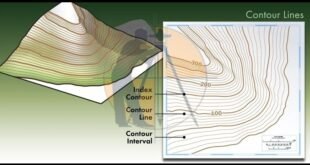
Contour Mapping – Characteristics, Methods & Uses. The Contour are the lines joining the points of equal elevation on the surface of earth or we can say that the contour is a line in which the ground surface is intersected by the level surface obtained by joining points of the …
Read More »What is The Contour Mapping