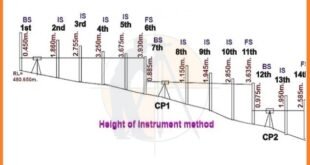
How to Calculate the RL by HI Method in Surveying. In this article i will explain how to Calculate the RL by HI method in surveying, Let us consider an example as given below. The leveling instrument was used to observe the subsequent readings. 0.450, 1.860, 2.755, 3.250, 3.675, 3.930, 0.885, …
Read More »Interview Question and Answer For Land Surveying
Interview Questions and Answers For Land Surveying R u gearing up for an interview in the Civil Engineering for The Land Surveyor position? Congratulations on taking the step toward a rewarding career! To help u ace your upcoming interview, we have compiled the comprehensive list of the top 105 interview …
Read More »Civil Engineering Field Knowledge
Civil Engineering Field Knowledge. Useful Information For Land Surveyor And Civil Engineers, Get Benefits And Share With Other. Civil engineering field knowledge encompasses a wide range of practical skills and expertise needed for the planning, design, construction, and maintenance of civil infrastructure projects. Here’s an overview of some key aspects …
Read More »Civil Engineering Basic Knowledge
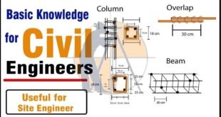
Civil Engineering Basic Site Knowledge. Useful Information For Land Surveyors And Civil Engineers. Get Benefits And Share With Others. Definition and Scope: Civil engineering is a branch of engineering that deals with the design, construction, and maintenance of infrastructure, including buildings, bridges, roads, dams, and other large-scale projects essential for …
Read More »How to calculate the Quantity of Earthwork in the Road
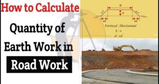
How to calculate the Quantity of Earthwork in Road. In this Article u will learn step-by-step guidelines for measuring the QTY of earthwork (soil) in the Road, railway & the canal work with the help of mean area method. For explanation, the solution is given in the following example. Example …
Read More »Rise and fall method with Examples
Rise and fall method with Examples. In This Article i will discuss About the topic of Rise and Fall Method with Complete Detail. Rise & fall is the method of Land Surveying to solve the levelling to find out difference in elevation & elevation of 2 points. In this method …
Read More »How to calculate The gradient, run and rise in civil construction
How to Calculate Gradient, Run and Rise in Civil Construction. In this Article i will calculate the slope, run & rise in the three different drawings as shown below. 1 – Slope calculation. Given Data. Run = 15m. Rise = 0.5m. Slope = [run ÷ rise] = [15m. ÷ 0.5m]. …
Read More »Types Of Scales In Surveying
Types Of Scales In The Surveying. Since the Surveyed area is the very large, it is never possible to make full size of drawing. For convenience it is generally necessary to draw them to the reduced size, this operation is called ( drawing to scale). There are 2 types of …
Read More »What is Alignment of Road
What is Alignment of The Road ? The position occupied by the center line of the Road in plan is called alignment of road. The new road should be aligned very carefully as the cost of the Construction, maintenance, safety & ease in travel etc. depends much upon the alignment …
Read More »What is the Benefits and Drawbacks of Total Station
What is the Benefits and Drawbacks of Total Station. Definition of the Total Station Now-a-days The Total Station is the most popular software for Land Surveyors to use on the job site. The total station is created by combining an electronic theodolite, an electronic distance measuring device (E.D.M) & a …
Read More » Surveying & Architects A unique platform of Civil Engineering


