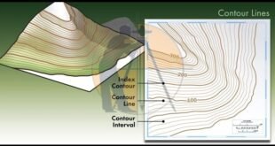
Contour Mapping – Characteristics, Methods & Uses. The Contour are the lines joining the points of equal elevation on the surface of earth or we can say that the contour is a line in which the ground surface is intersected by the level surface obtained by joining points of the …
Read More »Rise and fall method with Examples
Rise and fall method with Examples. In This Article i will discuss About the topic of Rise and Fall Method with Complete Detail. Rise & fall is the method of Land Surveying to solve the levelling to find out difference in elevation & elevation of 2 points. In this method …
Read More »What is the Benefits and Drawbacks of Total Station
What is the Benefits and Drawbacks of Total Station. Definition of the Total Station Now-a-days The Total Station is the most popular software for Land Surveyors to use on the job site. The total station is created by combining an electronic theodolite, an electronic distance measuring device (E.D.M) & a …
Read More » Surveying & Architects A unique platform of Civil Engineering


